Gettysburg Discussion Group Map Room


These maps represent the development of the Gettysburg Battlefield from 1883 through 1913, the period when most of the monuments were dedicated and the roads to them laid.  They document the evolution of the field from the battlefield of 1863 to the memorial field of today.


The Gettysburg Battlefield Memorial Association Maps
(Click on the DATE for map annotations. Click on the Map for map image.)

1883

1885

1886

1895

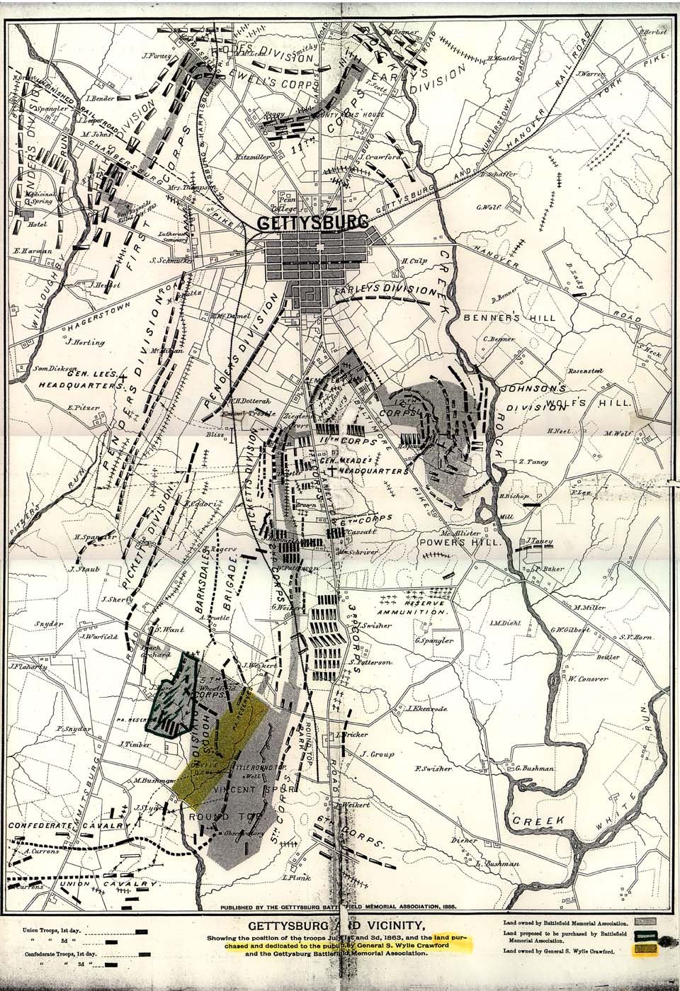
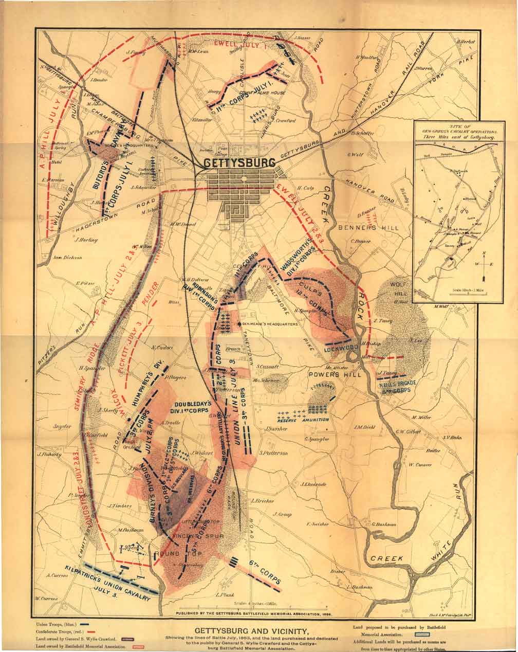
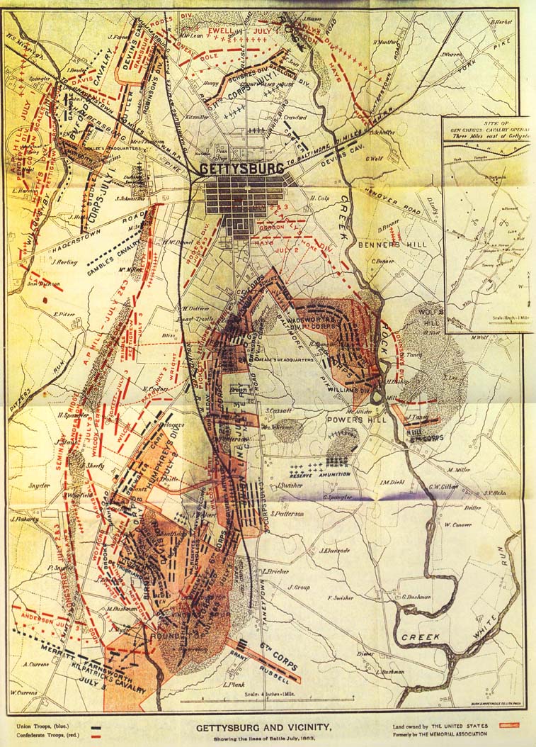
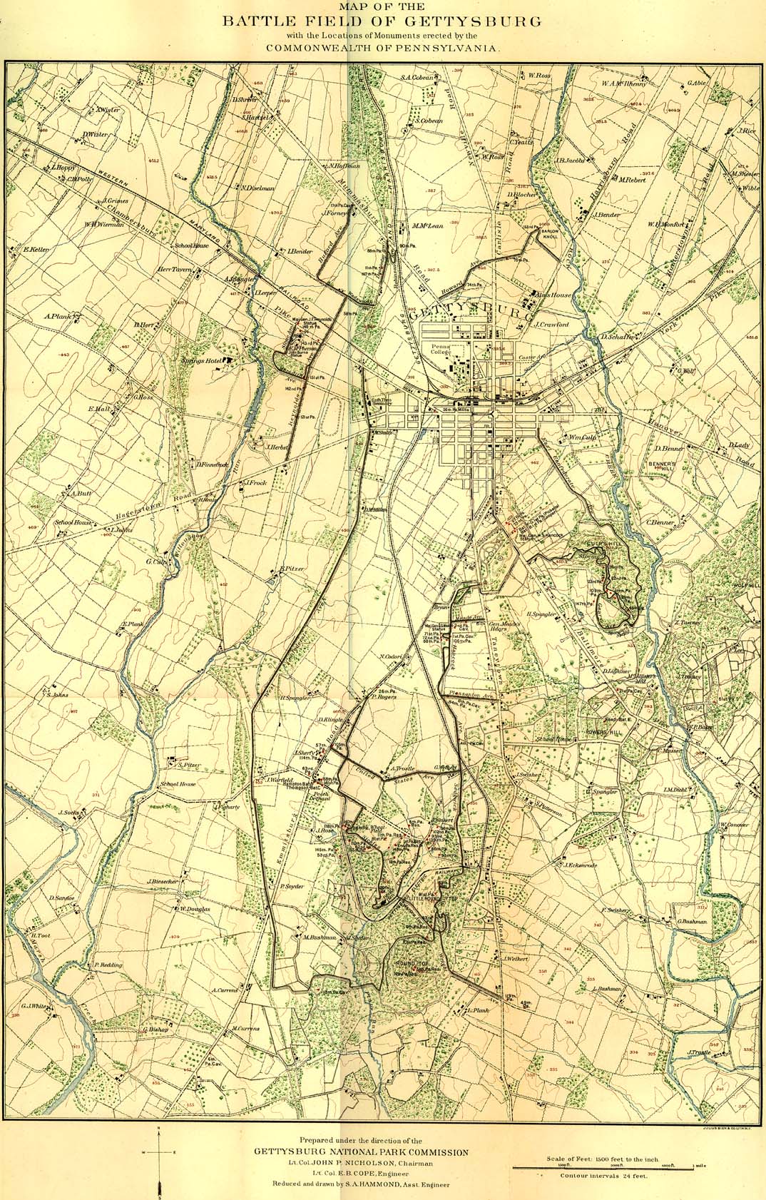
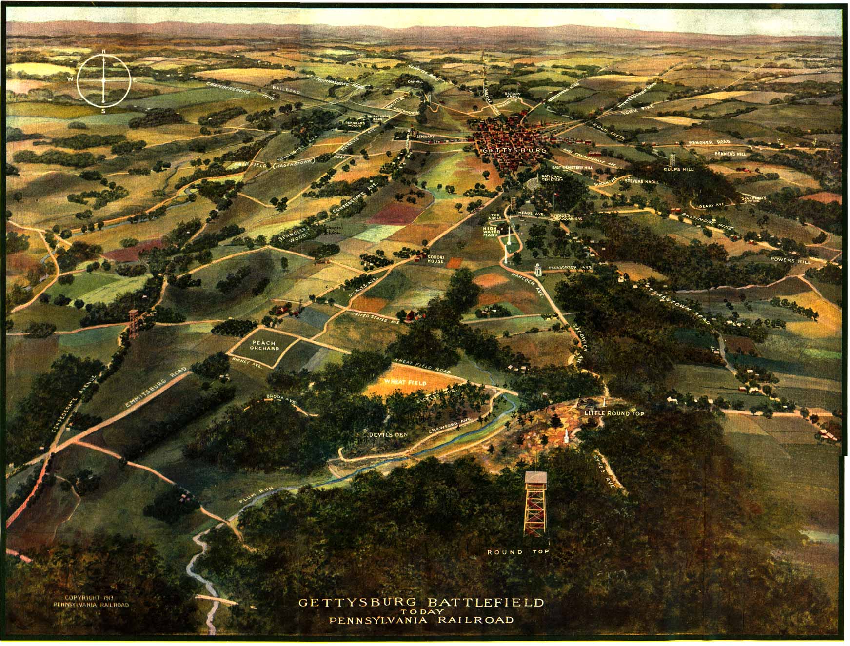
In July of 1882 the board of directors of the GBMA, upon motion of General Louis Wagner, resolved "to make a map of the battlefield so as to show what we own of it. This to be used in connection with our efforts after appropriations."

The map as envisioned by the GBMA would: "show the town, all the roads and streams, hills and mountains, names of principal owners of land, our property in pink, Crawford's blue, position of rebel troops (3rd days fight) red, and Union troops blue, also names of Division and Corps Commanders on both sides."

(For complete annotations, click the individual map dates.)

Pennsylvania at Gettysburg Map
1904


This map is undoubtedly THE finest representation of the battlefield of Gettysburg, as it appeared at the height of the U.S. War Department park-building effort. It is found in Volume 2 of Pennsylvania at Gettysburg in both the 1904 and the 1914 editions of the publication (the 1893 edition does not contain the map).

Prominently represented on this map are the newly built War Department avenues, all of them conspicuously labeled. Some of these original avenues have been rerouted or even removed over time, (eg: Sykes and South Confederate avenues have been rerouted. Webb and Chamberlain avenues have been removed) so that this map serves as an invaluable documentation of the paths followed by the original roadways.
(For complete annotation, click here)

Download Hi-Res map (1.8Mb) (pagb1904.zip)

Pennsylvania Railroad Map
Gettysburg Battlefield Today
1913

The 1913 Pennsylvania Railroad map easily rivals Bachelder's Isometric Drawing of the battlefield of Gettysburg, in visual beauty, presentation, and in the amount of information conveyed to the viewer. 

The perspective of Bachelder's Isometric Drawing is that of an observer "in a balloon suspended in air two miles east of Gettysburg, looking west over the terrain." The Pennsylvania Railroad map portrays the field in a similar fashion with the observer suspended over the southern portion of the field, looking towards the north.

Perhaps the most impressive aspect of Map 4 is the phenomenally detailed depiction of the battlefield as it existed at the time of the 50th anniversary of the battle. The lack of encroachment of woodland on the sight lines surrounding Plum Run and the Slyder farm are a striking contrast to the field seen today.
(For complete annotation, click here)