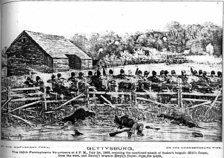
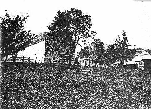
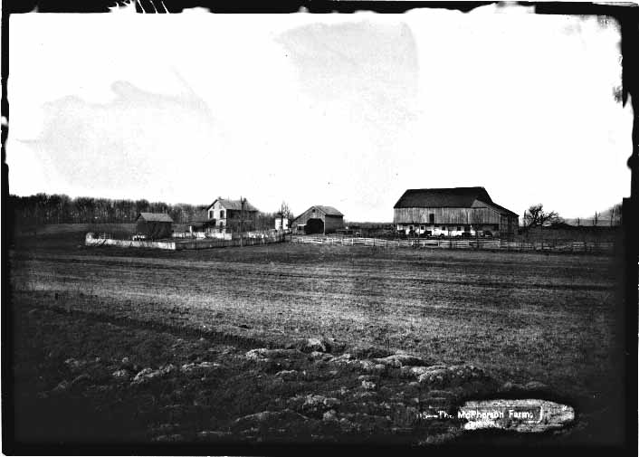
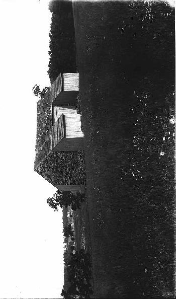
 #1 Franz Lesshafft's painting "At the McPherson Farm, on the Chambersburg Pike," from
Thomas Chamberlin's History of the One Hundred and Fiftieth Regiment Pennsylvania Volunteers, Second Regiment, Bucktail
Brigade (Philadelphia, 1905).
#1 Franz Lesshafft's painting "At the McPherson Farm, on the Chambersburg Pike," from
Thomas Chamberlin's History of the One Hundred and Fiftieth Regiment Pennsylvania Volunteers, Second Regiment, Bucktail
Brigade (Philadelphia, 1905).Iconographic Representations
#1 Franz Lesshafft's painting "At the McPherson Farm, on the Chambersburg Pike," from
Thomas Chamberlin's History of the One Hundred and Fiftieth Regiment Pennsylvania Volunteers, Second Regiment, Bucktail
Brigade (Philadelphia, 1905).
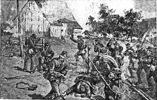
#2 Alan C. Redwood, engraving in Battles and Leaders of the Civil War, Vol. III (New York, 1888), p. 278.
Redwood's drawing shows the barn from a point almost identical to the angle of Lesshafft's painting, While Redwood heightens the barn beyond its true form, he drew his embrasures more pronounced than Lesshafft, and showed the siding on the lean-tos as horizontal on the south shed and vertical on the north shed. 125 #3 and #4 Samuel Murray, sculptor, Pennsylvania Memorial west facade (Harrison Granite Co., contractor), GNMP.
Samuel Murray's relief of action along the Cashtown Pike, is quite similar to Lesshafft's painting (no. 1). The view is the same, showing the barn from the north. Murray shows the north gable wall accurately, with the five embrasures. The house seems to be the post-war two-story frame.
126
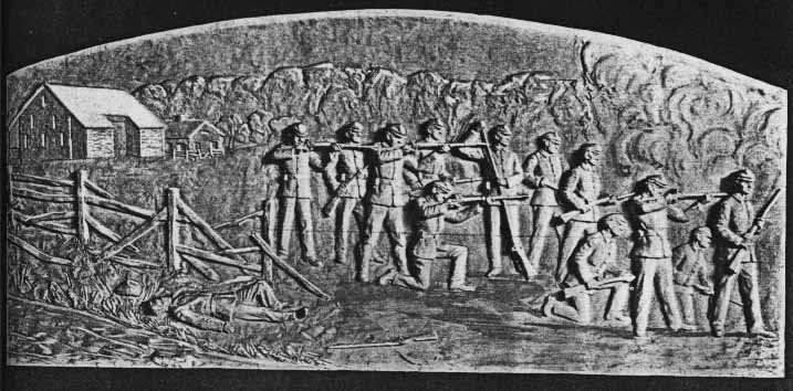
#3 Samuel Murray, sculptor, granite relief, Pennsylvania Memorial, west facade; Gettysburg Battlefield Memorial Commission, Pennsylvania at Gettysburg (Harrisburg, 1914), p. 66.
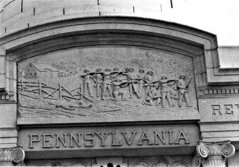
#4 Samuel Murray, sculptor, granite relief, Pennsylvania Memorial, west facade, GNMP. 127
#1 Matthew Brady photograph (on or about July 15, 1863). One-half of stereo view. This hitherto unpublished photograph is in private ownership. It shows clearly the back/log/kitchen part of the McPherson farmhouse (extreme right of photo). The stone section of the house is obscured by the tree to the left of the log kitchen. Brady and his assistant stand between the wagon shed and the farmhouse. The barn is at the left of the photograph.
129
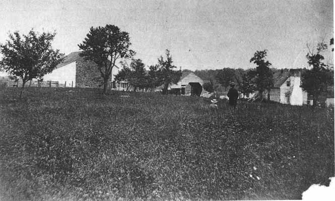
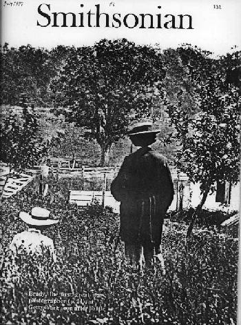
#2 Enlargement of Matthew Brady photograph, Meserve Collection (see no. 3), cover of Smithsonian magazine, VIII, no. 4 (July 1977).
While concentrating on the figures of Matthew Brady (standing) and his assistant, this enlargement shows clearly the whitewashed stone section of the McPherson tenant house, as well as the pig pen fencing (just below Brady's left elbow). Fencing along the Cashtown Pike is also apparent, as well as the remnants of wardamaged board fencing of the lane and barnyard.
#3 Matthew Brady photograph; one half of stereo view.
This stereo photograph by Matthew Brady is also owned privately, being held by the Meserve Collection of New York City (courtesy of one of three trustees of the collection, Mr. Philip B. Kunhardt). This section shows the wagon shed and corn crib to the right of the photo, with the fencing along the Chambersburg Pike visible through the wagon opening. Fruit trees in differing stages of development extend across this part of the photograph--one young tree is apparently dead. The larger trunks and just the tops of the "old cherry trees" that paralleled the lane are barely visible behind the whitewashed posts of the barnyard. Seated in front of the wagon shed is a couple, one apparently female and the other male-perhaps John and Eliza Slentz. The stone bank barn dominates the left half of the photograph.
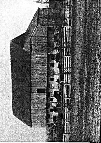
#4 McPherson Barn, enlargement of #3. This is the only view of the 1863 McPherson Barn, and is extracted from the enlargement of the half-stereo belonging to the Meserve Collection. The stone wall rises from the foundation to the gable and is topped by a bargeboard. The wall has five embrasure
ventilatorslits in a sequential progression from top to bottom of a staggered 1 - 2 - 3. While this part of the stone wall is natural, traces of whitewash overlap the eastern (right) edges of the wall where it joined the forebay siding and where the exterior stable wall was also whitewashed. Not having a contemporary, photograph showing the eastern front of the barn, it is difficult to speculate as to the length of the lean-to or pent roof which extends out from the barn. The access to the stable area also seems to be partially enclosed with siding extending down from the forebay. The two ventilator-barred windows in the south foundation wall are still extant today, as is that much of the stone wall up to the bottom row of embrasures and the ends (see p. 89). The lean-tos, in relation to the fixed width of this south end wall, were at least 21 feet long (compared to a length of a little over 12 feet today). The south lean-to had horizontal
135
siding, and the north shed had vertical siding. The widths of the siding boards are not uniform, some being as much as 15 inches wide, while others were, about 8 inches wide. It is not apparent where the double-hung wagon doors gave access to the threshing floor because of the interference of the fruit tree (but see #17 and #19). The sheds had a whitewashed loose stone foundation for two-thirds (or a little over fourteen feet) of their length and then seem to have rested on end piers. The roof line kicks out where it joins the sheds so that the roof pitch is no longer the same over the sheds as over the barn.
#5 Matthew Brady photograph of McPherson Farm and Herbst Woods, looking east-southeast (on or about July 15, 1863).
This photograph was taken from a point just east of the quarry and looks toward the Herbst woodlot. This woodlot is grove-like, and free of
undergrowth and small trees. 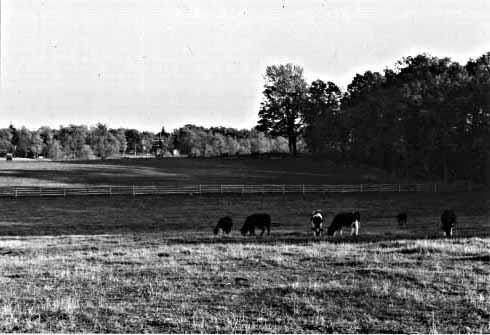 The worm fencing along the northern boundary of the woods (designating the McPherson-Herbst boundary)
lies scattered about where it had been knocked down. Brady and his assistant stand in the same weeds and grass (the meadow) that show up
in photos no. 1- 4. The post and rail fence which separated the cornfield in the middle ground from the meadow in the foreground was
likewise knocked down. Only the small trees and growth show where the fence line was. This photo disproves the Warren Map as far as the
McPherson orchard goes. Warren, whose engineers surveyed the grounds in 1868-69, placed the McPherson orchard extending from the
farm buildings as far southward as Herbst Woods, as far westward as the quarry, as far eastward as the lane.
The cupola of the Lutheran Theological seminary rises in the distance.
The worm fencing along the northern boundary of the woods (designating the McPherson-Herbst boundary)
lies scattered about where it had been knocked down. Brady and his assistant stand in the same weeds and grass (the meadow) that show up
in photos no. 1- 4. The post and rail fence which separated the cornfield in the middle ground from the meadow in the foreground was
likewise knocked down. Only the small trees and growth show where the fence line was. This photo disproves the Warren Map as far as the
McPherson orchard goes. Warren, whose engineers surveyed the grounds in 1868-69, placed the McPherson orchard extending from the
farm buildings as far southward as Herbst Woods, as far westward as the quarry, as far eastward as the lane.
The cupola of the Lutheran Theological seminary rises in the distance.
138
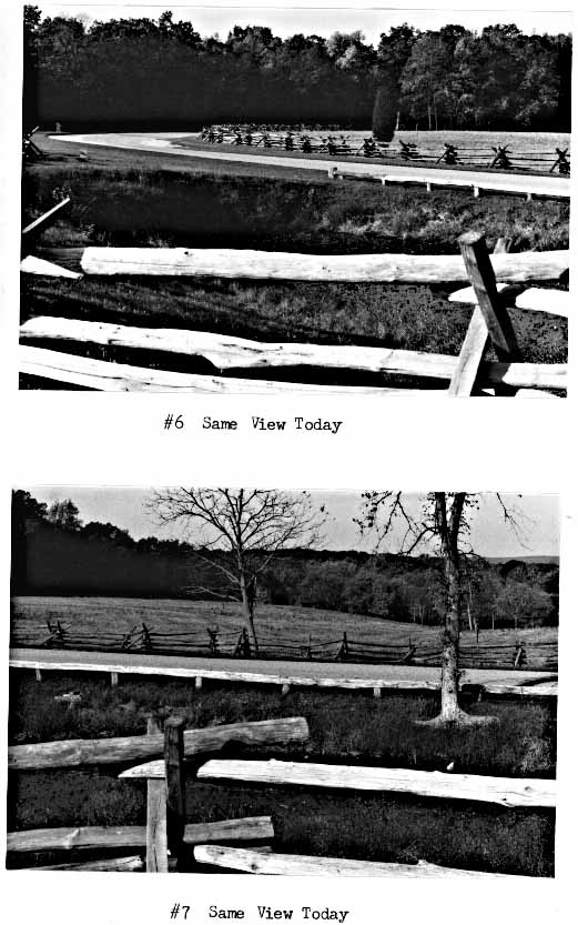
#6 and #7 Matthew Brady photographs (on or about July 15, 1863).
These Brady photographs depict the McPherson quarry from a point just behind it looking southwestward. Present-day Stone Avenue cuts across the length of the photograph today; the log guardrail stands where Brady stood. Most of the fencing around the quarry was undisturbed since none of the troops could have fought on its steep sides or in its water. The post and rail fence extending towards Herbst Woods, however, is minus all its rails. Two small fruit trees (?) are crowded just south of the quarry, where they would have been within the post-and-rail fence. The field west of the quarry and post and rail fence must have been a good growing grass or wheat before it was trampled in places. The fencing is of five rails to each panel in the post and rail while the worm seems to be of six and seven rails (same as Sherfy Farm photo ca. late 1860s-early 1870s). What the purpose is of the vertical pole by Brady is unknown. Herbst Woods dominates the horizon. Herr Ridge Woods is visible in the right background, though, where the McPherson field slopes down rapidly to meet Willoughby Run.
140
141
142
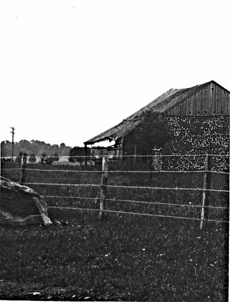
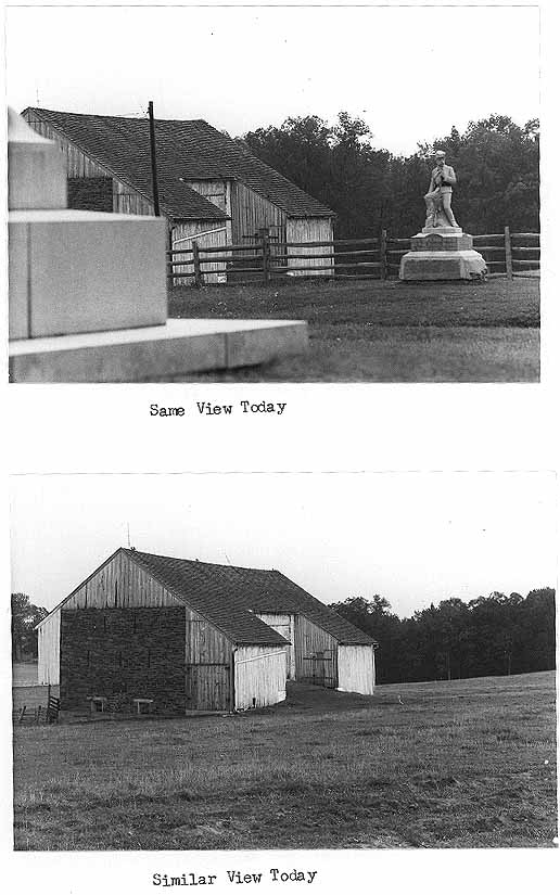
#8 William H. Tipton photograph, early 1880s.
This photograph looks westward from a point where today's Reynolds Avenue intersects the Chambersburg Pike (at the place where the monument to the 143rd Pa. stands). It shows the post-war condition of the farm while still tenanted. That it is still a working farm is attested to by the cows in the barnyard and the plowed field. The barn dominates the right of the photograph, with the added lean-to shed on the north end quite apparent. To the left of the barn is a wagon shed quite similar to the one which appears in the Brady photo (see nos. 1 and 3). This wagon shed appears to be the same general size, but it has vertical and board and batten siding where the original had horizontal siding. The shed is also oriented perpendicular to its 1863 position. It may be possible that the structure was moved and rehabilitated sometime after the battle.
The farmhouse has also been altered by the time of this photo--the original stone house has been replaced by the two-story yellow frame structure. The log kitchen remains, however, as a cross-gable to the frame dwelling and is visibly attached to the left of the house. Herbst Woods rises in the left background and extends down towards Willoughby Run. The last of the war-time "old cherry trees" stands crippled along the lane just right (north) of the barn.
144
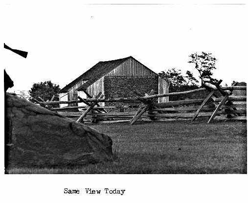
#8 William H. Tipton photograph, early 1880s.
 Same View Today
145
#9 William H. Tipton photograph, 1880s, farmhouse, enlarged.
This section of the preceding photo has been blown up to show the altered farmhouse and wagon shed, as well as the family garden area.
146
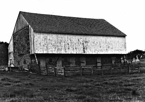
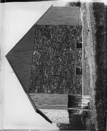
#10 William H. Tipton photograph, 1880s, barn, enlarged.
This enlargement of no. 8 shows the McPherson Barn about twenty years after the battle. The substantial lean-to shed has been added to the north end of the barn by this time. The north stone wall rises to the gable, but is mostly covered by the shed. The stable wall is whitewashed as it was in 1863, while pigeon holes have been cut into the siding of the forebay to the left of the winnowing/loading door. The ragged condition of the barn roof indicates that it might still be original 1863 roofing material.
148
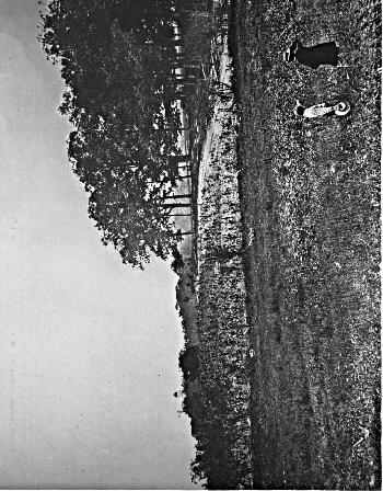
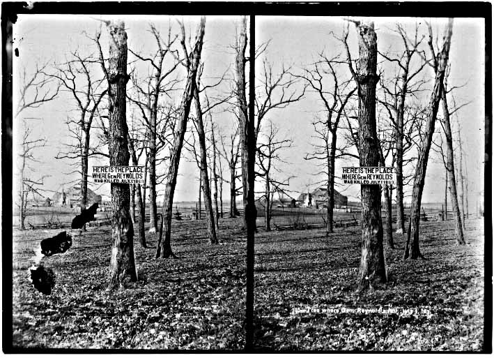
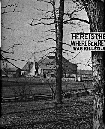
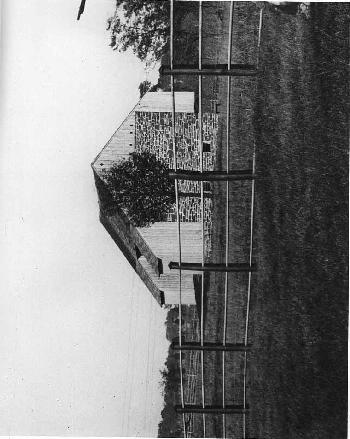
#11 William H. Tipton photograph, #1786, prior to 1886, from Herbst Woods.
This stereo view focuses on the supposed site of Reynolds' death in Herbst Woods. Discernible in the background are the McPherson farm buildings. Since this photo was made prior to the erection of the Reynolds marker, it must have been taken before the summer of 1886. The same buildings which appear in no. 8 as well as the absence of foliage on the trees, may indicate that photos no. 8 and 11 were taken at the same time.
150
This enlargement reveals that the south end stone wall was no longer intact by the mid-1880s. The gable siding clearly shows. The gable end of the kitchen wing of the farmhouse faces the camera, its exterior chimney quite pronounced. A comparison of the configuration of this chimney and its adjacent gable window with those which appear in the 1863 photo (no. 1), indicates that the structures are the same.
152
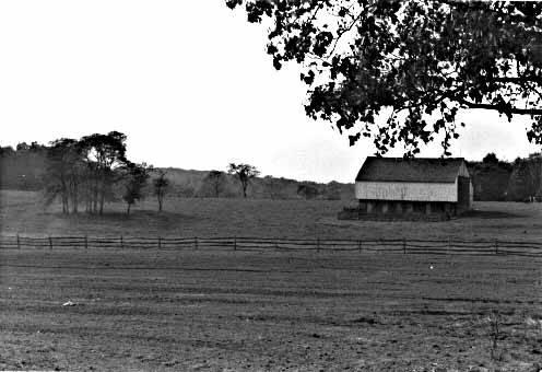
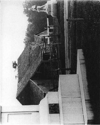
#13 William H. Tipton photograph, ca. 1895-1896, from Oak Ridge Tower, enlargement.
This photo, taken from Oak Ridge Tower, looks southwest, and shows the McPherson Barn. The other buildings are obscured by intermittent trees. The photo was probably taken shortly after the erection of the tower in 1895 when such a panoramic view would have been a novelty. Although the enlargement is not very clear, the original showed the datestone-cartouche clearly in the apex of the gable. By this time (ca. 1895), the north lean-to shed is still attached, and the north gable wall is still all stone.
154
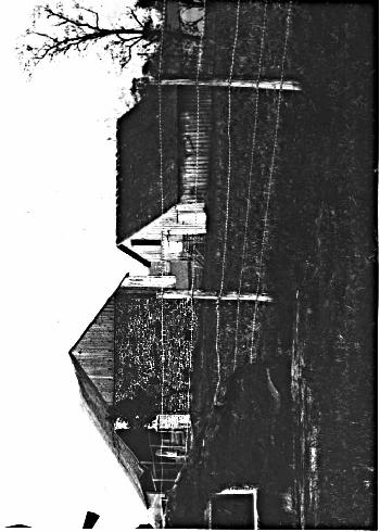
#14 William H. Tipton photograph, #2228, ca. March 1905, McPherson Barn.
This photo, taken sometime after 1899 and before June 1905, shows the condition of the barn after the farm was abandoned in 1895. The Reynolds Equestrian statue in the right background was erected in 1899, but the north shed was torn off in the summer of 1905, so the photo must date between those six years. Since the photo was apparently taken for the Commission it was probably photographed after the acquisition of the farm by the government in 1904. Its condition matches that described by Nicholson in March 1905 (see page 85).
From this photo it can be ascertained that the north end wall doubles back over four feet in thickness as an abutment. Today this same end of the wall is only two feet six inches thick (the south buttress is four feet six inches in thickness, and may be original; see page 89.)
By examining the siding, it will be noted that the forebay is the same as that of the early 1880s (re pigeonholes--see no. 10). The stable area is whitewashed yet, but all the doors are gone to the stables. The northernmost window (that one boarded over) shows the windows to be horizontal ventilator-barred windows like those two that show in the 1863 Brady photo (no. 4) of the barn's south wall. The ridge row lap of the shingles is the same as that of the 1863 Brady photograph.
156
 157
157
 Same View Today
This photograph was taken sometime after the farmhouse was burned down in 1895, but before the Reynolds Equestrian Statue was
erected in 1899. (Neither are visible in the photograph, when they would have been apparent had they been standing.) It complements no. 8,
in showing post-war outbuildings and later farm layout, and also verifies that the barn's south wall was probably suffering from structural
problems at that date, as evidenced by the gable siding in lieu of the original stone.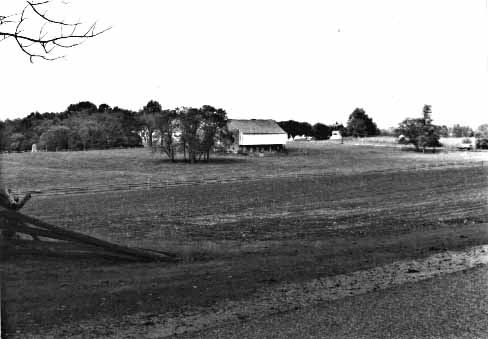
159
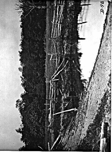
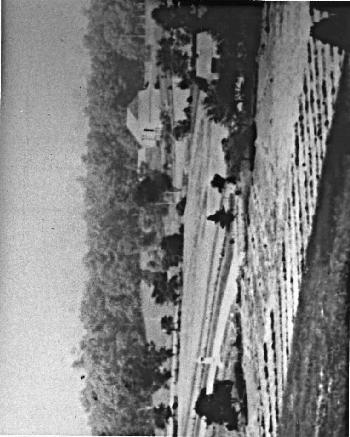
#16 William H. Tipton photograph, #2212, ca. 1902, Looking down Stone Avenue.
This photograph, probably taken in 1902 before Stone Avenue was telfordized and the John Burns Statue formally dedicated, was intended to illustrate the condition of the avenue before construction work improved it. The McPherson quarry lies to the right of the avenue at the swale (just between the 150th Pennsylvania monument and its left flank marker.) The John Burns Statue was just recently erected, since the grounds around it were not yet sodded and the cutting and pointing work on the foundation boulder are still fresh looking. In the right background are the deteriorated McPherson barn, the wagon shed, and shed1.
161
162
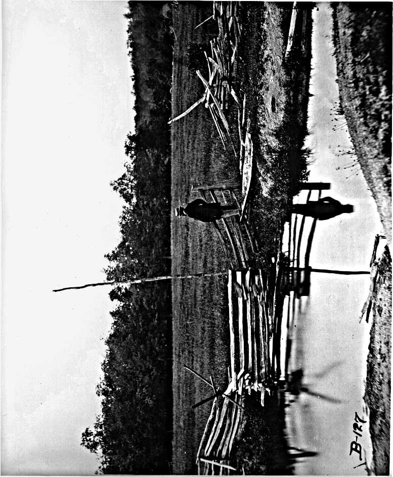
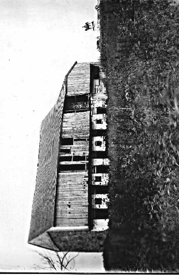
#17 William H. Tipton Photo, #2212, enlargement.
This photo reveals the poor condition of the barn near the end of its private ownership. The 1863 lean-to sheds are disintegrating by this time--the south shed is entirely gone. The framing where it was attached to the west wall is visible. (The horizontal member of framing was affixed not only to the end brace bars, but the bottoms of the embrasures were knocked out to accommodate additional joists.) The north shed has horizontal siding which looks of uniform width and fairly new. It is probably not the 1863 siding, since it does not look crude enough (see no. 4); besides, the north shed had vertical siding (see no. 4 and iconographic no. 2). It is interesting to note the remains of the original 1863 roof line over the sheds. The roof extended over the bank and was indented somewhat (ca. 2 - 3 feet) where the double-hung wagon doors were. Although the siding is in good shape on this north shed there is none on its south side, nor is there any bracing to accept any, leading one to speculate that there was no need for siding since the area was within the barn, enclosed by the wagon doors and projecting roofline.
The gable siding shows the same pigeon holes as no. 14.
The same horizontal-barred ventilator window which still exists in the west foundation wall, is visible below the horizontal framing attached to it.
163
#18 William H. Tipton, photograph, 1903, enlarged (Annual Report, GNMP Commission, 1903).
This enlarged portion of a Tipton photo shows the condition of the McPherson Barn within a year after the previous photo (no. 17). All the siding has been taken or fallen off of the remaining lean-to shed, leaving only the sagging roof and a few joists and braces.
166
#18 William H. Tipton photograph, 1903, enlarged (Annual Report, GNMP Commission, 1903).
#19 William H. Tipton photograph, 1903, #2234, enlargement
This enlargement of a Tipton photograph which focused on the Reynolds Equestrian Statue faces south, and shows the dilapidated condition of the McPherson Barn at about the same time as the previous photo (no. 18). Both west stone walls are visible as well as that part of the north wall above the post-war lean-to addition. This north gable wall has little noticeable pointing and seems to be in pretty rough condition. The remains of the indented cartouche datestone are visible in the apex of the gable.
The 1863 roof line of the west lean-tos is most revealing in this photo. It is clearly visible in this photo that the roof was indented about two feet where the double-hung doors gave access to the threshing floor--the trim board is there, indicating that this indentation was planned and not any accidental caving in of the edge of the roofing there.
The northern of the west stone walls shows that it was identical to its southern section--even to the arrangement of embrasures, the barred ventilator window, and the framing for the lean-to shed. It is also noticeable that there are no double-hung doors between the two sections of the west wall, nor any accommodations for them, as there is in the 1905-1977 barn, because the doors were not there, but out at the end of the roof line near the edge of the sodded ramp.
168
 169
169
#20 William H. Tipton photograph, spring 1906, Annual Report GNMP Commission (1906).
This photograph was taken to show the rehabilitated McPherson Barn after the construction work of John Irwin was completed in the summer of 1905. This view illustrates the changes made by Irwin--the new, foreshortened lean-to sheds on the west side, the relocation of the wagon doors, and the elimination of the plastered cartouche in the north gable (see no. 19). Irwin replaced the worn-out wood shingles where needed over the barn proper and repointed the weathered north gable (the line of the repointing is obvious). The five staggered ventilator embrasures are visible in a photograph for the first time due to the elimination of the post-war lean-to. The trees of Herbst Woods are seen in the right background, and still gives an open grove-like appearance between the trees. Only large, spaced trees are visible, and the ground cover is primarily grass, not brush as it is today.
171
#21 William Tipton photograph, ca. 1905, #2224, enlargement.
This photo shows the south end of the McPherson Barn in its "restored" state after Irwin's work in the summer of 1905. The gable pine siding is the same as the 1880s photos indicate (re pigeon holes) but has been whitewashed. The new lean-to sheds are much shorter than the original lean-tos. Because they were foreshortened, Irwin was able to change the pitch of the roof-line of the lean-tos so that it matched that of the barn. An altogether new foundation has been placed under that lean-to visible here (compare pattern of stones with 1863 photo no. 4).
The south wall no longer has the ventilator embrasures noticeable in 1863 (no. 4) and 1902-1903 (nos. 17-18), since Irwin took down the cracked and bulged central part of the wall and rebuilt it anew without putting back the characteristic slits (see page 89).
173
#22 William H. Tipton photograph, spring of 1918, #3278, Annual Report GNMP Commission (1918).
This photo reveals part of the work undertaken by Charles Kappes (September-November 1917) after the north end wall collapsed. The poured concrete foundation runs along the base of the new ventilator windows (indeed, it acts as the very window sill). A concrete foundation has also been put under the northern of the west lean-to sheds. The belt of concrete continues around to the east stable wall as far as the third stable door. The darker gable siding contrasts the whitewashed siding of the lean-to and forebay, since it was painted to blend with, and give the impression from a distance of being, stone. The fake embrasures slash through the, as yet, unpointed replacement stone wall. The galvanized metal roofing is visible as it laps over the bargeboard and at the eaves. The new lightning arrestors and ground wire are also visible.
Note the still "open" grove-like appearance of Herbst Woods in the background.
175
176
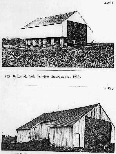
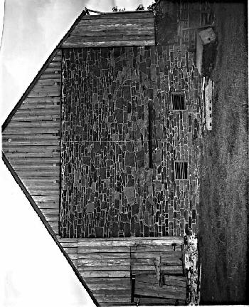
#23 National Park Service photographs, 1936.
These photos show the upkeep condition of the McPherson Barn under the administration of the National Park Service. Since 1905 (no. 21), a double-hung door had been cut into the south end of the southern lean-to shed, as well as the north end of the northern shed. The siding in the south gable is still, apparently, the 1880s siding, as the arrangement of pigeonholes are the same (although now boarded up).
177
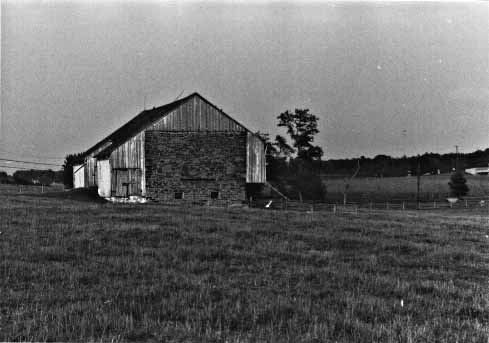
#24 National Park Service photograph, 1958-1959.
This photograph accompanied the Historic Structures Report of 1958-1959 and shows the barn when in use by a permittee. It is the same view as no. 14. Some whitewash remains on the stable wall. Part of the newly whitewashed siding shows that some of the early 1880s siding is still extant (compare with nos. 10, 14, 17, 18, and 21), by the late 1950s.
179
180
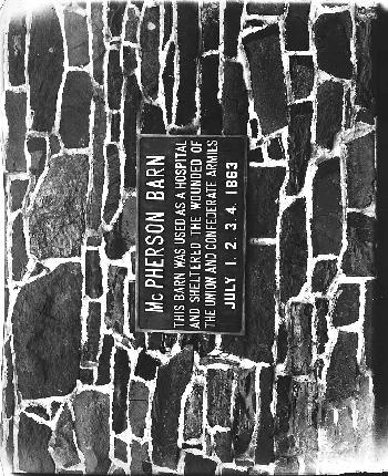
#25 William H. Tipton photograph, 1907, #2946.
This photograph of the McPherson Barn Hospital Tablet shows the condition of the north end stone wall some two years after the lean-to addition was taken off by Irwin. The cracking stone and mortar may show early rapid deterioration after exposure to the weather. This wall would collapse in 1917.
The numeral "4" was effaced from this hospital tablet an unknown number of years ago (it shows up in the 1918 photo [no. 22] as well as the 1936 one [no. 23]), and for questionable reasons. Research indicates that the barn was used as a "hospital" from July 1 to at least July 5, 1863, so it would have been correct to leave the "4" alone.
181
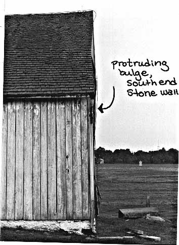
#26 National Park Service photograph, September 1977.
This photograph looks straight-on at the west facade of the barn,, showing the south end. Instead of being a perfect plane, the shifting end wall protrudes from the plane.
#27 National Park Service Photograph, October 1977.
This photo shows the condition of the exterior woodwork at the south end of the barn, as well as the subject stone wall and the 1917 steel angle bar which holds the tie rods. The non-historic doors on the non-historic shed are rapidly deteriorating. The forebay itself is pulling away from the bulging and shifting wall, as evidenced by the space between the siding and the edge of the wall. Interestingly, the gable siding still extant today is that same siding with pigeonholes that dates to at least the 1880s. The forebay siding has all been replaced.
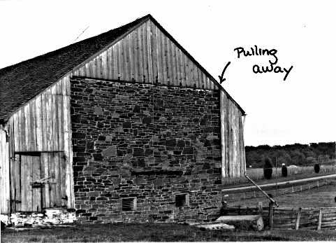
#28 National Park Service photograph, October 1977.
This photo shows the present condition of the south end wall. The crack is clearly visible in this photo although the bulge does not appear from this angle. The crack follows the exact line where the original section of the stone wall meets the 1905 replacement (see page 89).
185
186
187
Memorandum
To: Team Captain, Historic Preservation Team
From: Exhibits Specialist (Restoration)
Subject: McPherson Barn, Gettysburg NMP
An inspection was made on March 8, 1973, with Tom Harrison, Chief, Resources Management, Gettysburg National Military Park.
Little could be seen of the interior because the upper story of the barn was full of baled hay and the bottom was full of manure.
From the time this structure was built c. 1840, agriculture practices have changed drastically. Consequently, the use of the barn has changed. If this barn is to be preserved, the current practices will have to be altered.
The storage of baled hay to the apex of the roof will have to be stopped. The weight of baled hay is about three times that of loose hay. Therefore, the barn is being subjected to loads it was never intended for. The results of these loads are evident, particularly in the south end of the barn which has moved about 8 inches and the forebay overhang has moved 3 inches. The original summer beam had to be replaced two years ago. The barn is spreading apart at the rafter line. If this indiscriminate use continues, the upper portion will suffer irreparable damage.
The barn is used as a feed lot operation, allowing cattle to run all winter in the barnyard and lower portion of the barn. The manure has built to a depth of five feet. This situation is subjecting the wooden posts carrying the upper portion of the barn and door jambs, to unusual and extreme wetting conditions. This building was never intended for this type of operation.
The barnyard has from 12 to 18 inches of mud and manure. I find this a very objectionable condition.
A program should be instituted to alleviate these conditions as quickly as possible. Funds for the repair of this damage should be made available as soon as possible.
[SIGNED] James S. Askins
cc:
Supt, GNMP
T. Harrison, GNMP