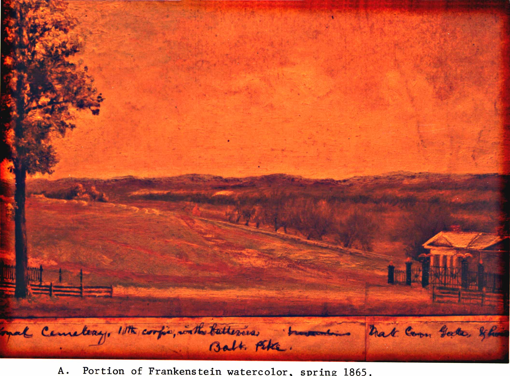
(Gettysburg College collection)
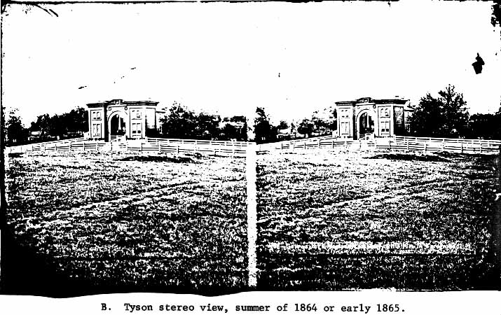
(Tipton collection, GNMP)
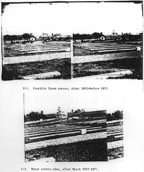
C-1. Possible Tyson stereo, after 1865-before 1871.
This view looks from the Delaware section of soldiers plot toward entranceway and gatehouse. This Greek Revival gatehouse was altered prior to August 1871, giving more room to the second floor by adding a mansard roof. Originally the building was to serve as the superintendent's office, with a reception room/parlor for visitors, but by 1871 this structure was enlarged by the mansard roof and two upstairs rooms to accommodate the superintendent's family. The stereo shows the cemetery wall in the left background, with evergreens (Norway spruce) planted at intervals along the wall. The Baltimore Pike ornamental iron fence and gateposts are visible to the right of the gatehouse.
(Tipton Collection, GNMP)
C-2. Tyson stereo view, after March 1865-1871.
This view is almost identical to C-1, and shows the stone gatehouse as originally built, with its Greek Revival facade.
(GNMP files, former Darrah collection)
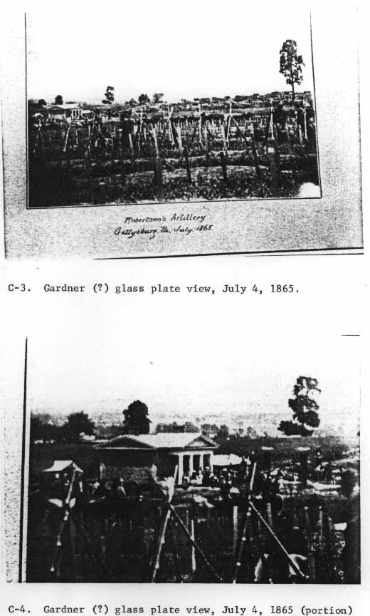
This view from near the site of the Soldiers' National Monument, looks through the post markers of the unknown section towards East Cemetery Hill. The Baltimore Pike fence and gates are up and ornamentation is gilded. The stone wall and the gas-pipe fence, though already erected, are not visible in this view.
(MOLLUS Collection, Military History Institute, Carlisle Barracks)
C-4. Gardner (?) glass plate view, July 4, 1865 (portion)
This is a close-up view of C-3. showing the open gates and the cast iron gateposts. The coping of the stone wall is barely perceptible as a light line transversing the "outhouse" tent at the left of the photo.
(MOLLUS Collection, Military History Institute, Carlisle Barracks)
This view is similar to C-1 and C-2, but it is taken from a point closer to the Baltimore Pike. The gates from the pike are closed, and the gilded eagles and urns are in contrast to the black-painted cast iron.
(GNMP files, former Darrah collection)
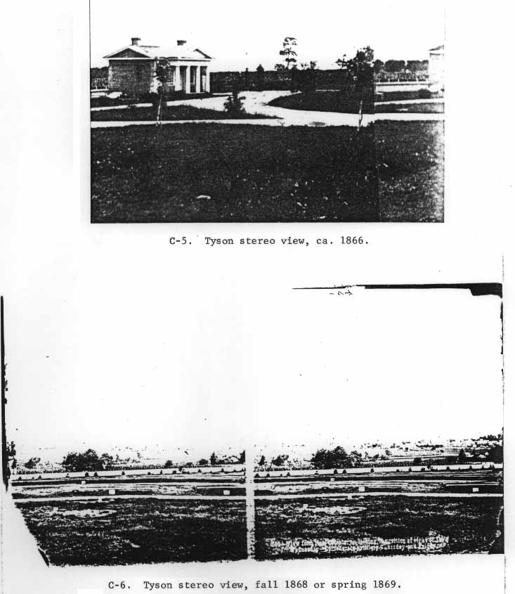
C-6. Tyson stereo view, fall 1868 or spring 1869.
This stereo view was taken from a point inside the proposed arbor vitae hedge and looked over the New Hampshire, Vermont, and New York sections of the cemetery. The stone wall is visible as the white horizontal bar, set off by the young Norway spruces (and one deciduous tree).
(Tipton Collection, GNMP)
C-7. Tyson stereo view, fall 1868 or spring 1869.
"View from Nat. Cemetery--looking to position of left of lst Corps on Wednesday--by Hill's Confederate Corps Thursday and Friday." The wall is again visible in this view, behind the spaced evergreens. The winch used in raising the Soldiers' National Monument is visible at the left of the stereo view.
(Tipton Collection, GNMP)
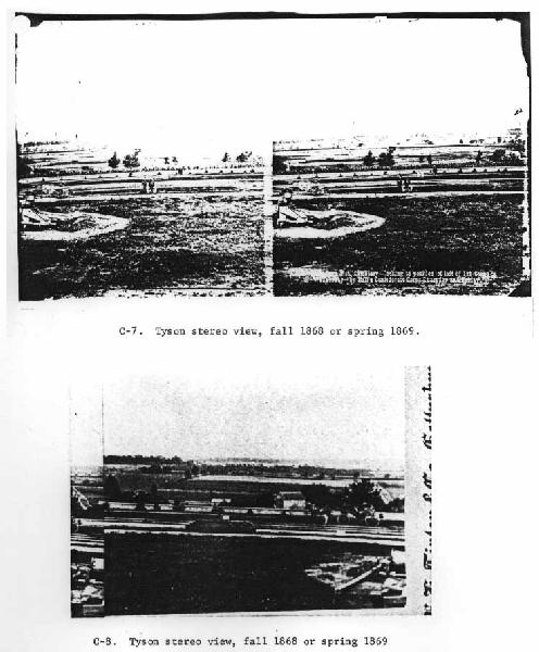
C-8. Tyson stereo view, fall 1868 or spring 1869.
Continuation of panoramic series C-6 and C-7, from near site of Soldiers' National Monument, showing stone wall with evergreen border in front. View looking over Wisconsin and New Jersey sections of the soldiers' plot. The open carriage is not on the lower drive but on the walkway separating the New Jersey and Pennsylvania plots. The winch for raising the Soldiers' National Monument is at the right of this view.
(GNMP files, former Darrah collection)
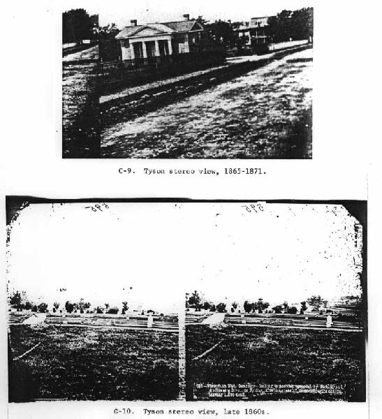
C-9. Tyson stereo view, 1865-1871.
View down Baltimore Street, showing brick walk to Evergreen Cemetery from the town, Baltimore Pike fencing and gates, and Greek Revival gatehouse. The ornamentation of the six gateposts are gilded, as is the urn finial at the end of the stone wall adjoining the Soldiers' Orphans Home and the Baltimore Pike (barely visible at the end of the iron pickets and beginning of wooden pickets at right of photo).
(GNMP files, former Darrah collection)
C-10. Tyson stereo view, late 1860s.
This view continues the panorama of the National Cemetery grounds, but the camera has now been moved to the south, overlooking the Maryland and Minnesota plots in the foreground. The marble vase and base adorning the Minnesota plot was the first regimental or individual state memorial on the battlefield, and apparently antedated the Soldiers' National Monument. The vegetation in front of the stone wall is evergreen and deciduous, and comprises those trees and bushes used to line the wall and grouped at the lower drive at the rear of the Ohio plot (see Map of the Grounds, Appendix C).
(Tipton Collection)
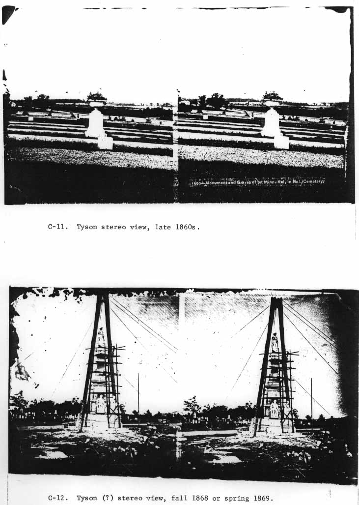
C-11. Tyson stereo view, late 1860s.
This view, concentrating on the marble memorial to Minnesota's fallen, is somewhat parallel to, but further north than, C-10 above. The deciduous trees visible at the left of the stereo view are those seen in the background of much of C-10.
(Tipton Collection)
C-12. Tyson (?) stereo view, fall 1868 or spring 1869.
This view shows the gas-pipe fence behind the Soldiers' National Monument with a low and intermittent arbor vitae growth. The Norway maple saplings planted on both sides of the upper drive are visible.
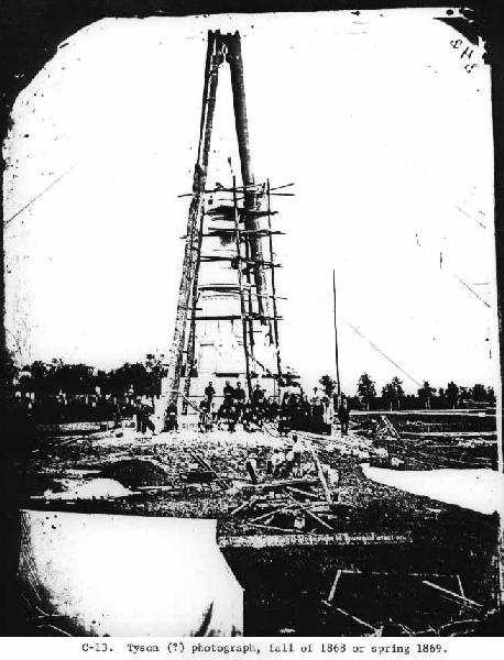
This view is similar to C-12, but provides much greater detail. The gas-pipe fence is located behind the monument, beyond the upper drive. The lines over the pulley at the center attached to the winch seen in photos C-7 and C-8. The rough-hewn pole behind the last man an the right was the original flagpole for the cemetery. It was heightened (or replaced) and relocated to its present position near the gatehouse in 1872, when the War Department took over. The inspector thought that the pole looked incongruous by the monument, and recommended in his 1871 report that it be relocated.
(GNMP files)
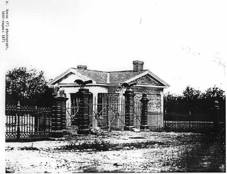
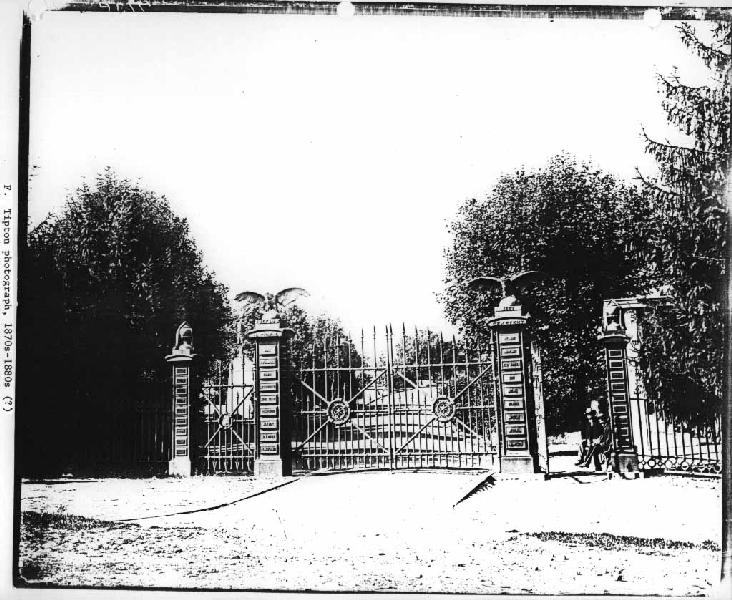
D. Tyson (?) photograph, 1865-August 1871.
This view of the entranceway to the National Cemetery was taken from the Baltimore Pike. The commanding subjects of the view are the ornamental iron gateposts, gates, fence, and the stone gatehouse. The ornamental eagles and urns do not seem to have the highly gilded appearance that is indicated in later photographs. This may have been photographed shortly after the gates and fence were erected in the spring of 1865, while the original foundry "gilding" or "bronzing" was intact.
The original gates are similar to those at Antietam National Cemetery and may have been cast by the same founder--Robert Wood and Company of Philadelphia. It does not appear that the center ornamentation in the gate panels were originally gilded as in later years. The purpose of the two large boulders at the central gateposts is unclear. They certainly do not appear in War Department-era photographs, and were probably removed when the entranceway was laid with brick sidewalk and otherwise improved.
(GNMP files)
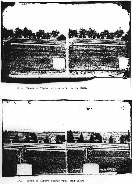
E-1. Tyson or Tipton stereo view, early 1870s.
This stereo view is taken from the Indiana section's headstone looking southwest. It shows the flourishing condition of the lower drive's deciduous trees, as well as the evergreen hemlock and Norway spruce along the cemetery wall. The building at the left, beyond the wall and on the other side of the Taneytown Road, is the post-war house associated with the brick yards (called the Dotterer house).
(Tipton Collection, GNMP)
E-2. Tyson or Tipton stereo view, mid-1870s.
This photographic view is comparable to C-8. although it was taken farther away from the Soldiers' National Monument. The Norway spruces inside the wall have quadrupled in size since the 1868-1869 photograph, while the War Department had begun to change the Saunders planting plans by adding small trees behind the stones at the head of the plots. The terra-cotta vases supplied by the War Department are visible in the middlegrounds of both stereo view E-1 and E-2.
The frame barn visible in C-8 and E-2 was part of the farm identified as belonging to H[enry] Bishop on the G.K. Warren map. The brick dwelling house at the right of the stereo view (but not in C-8) was probably constructed in 1868-1869, the same time that the Warren survey was made.
(Tipton Collection, GNMP)
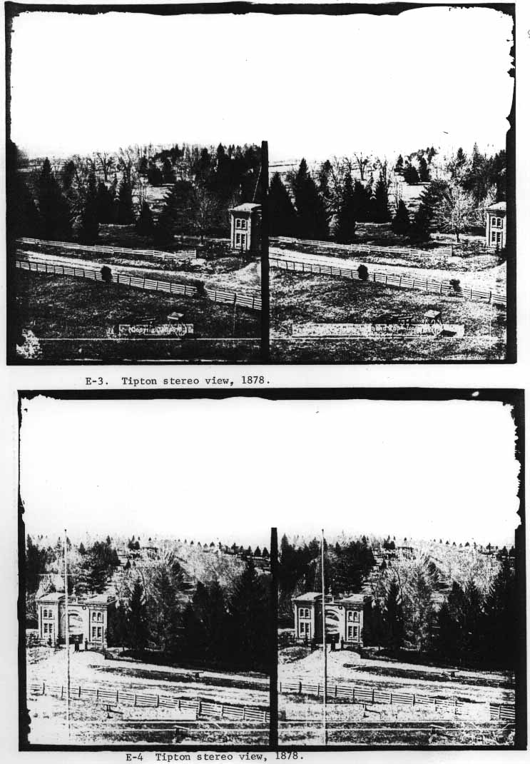
This view is from the East Cemetery Hill observatory, constructed in the spring of 1878. The view was probably taken shortly after or before the tower was opened to the general public. The shot shows the extension of the Baltimore Pike iron fencing to the Evergreen Cemetery gatehouse entrance, at the lower right.
The deciduous woodline in the background is the grove at the lower end of the Soldiers' National Cemetery and the Evergreen Cemetery, visible in 1863 photos as a formidable extension of Zieglers Grove.
(Tipton Collection, GNMP)
E-4. Tipton stereo view, 1878.
This is a continuation of the view E-3. and shows the Evergreen Cemetery gatehouse with the iron fencing contributed by the Soldiers' National Cemetery. Also visible at the right background is the Soldiers' National Cemetery, with its line of bare Norway Maples along the upper drive, and its evergreens along the Taneytown Road stone wall. The gas-pipe fence is visible just left of the line of maples.
(Tipton Collection, GNMP)
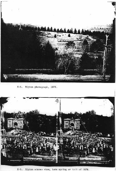
E-5. Tipton photograph, 1878.
Extending E-3 and E-4 to the right, or northward, this shot provides an excellent panorama of the National Cemetery as it appeared in 1878. The photograph, while not concentrating on the cemetery enclosures, is important in viewing the planting in the cemetery as of 1878 (six years after U.S. government control.) While the larger trees exhibit the original plan, the interior evergreens were planted by the War Department to "dress up" the open space. The belt of small arbor vitae circling the Soldiers' National Monument follows the original Saunders design. (Appendix C)
(Tipton Collection, GNMP)
E-6. Tipton stereo view, late spring or fall of 1878.
View similar to E-4, shows the Baltimore Pike fencing in front of the Evergreen Cemetery, and gas-pipe fence in right background.
(Tipton Collection, GNMP)
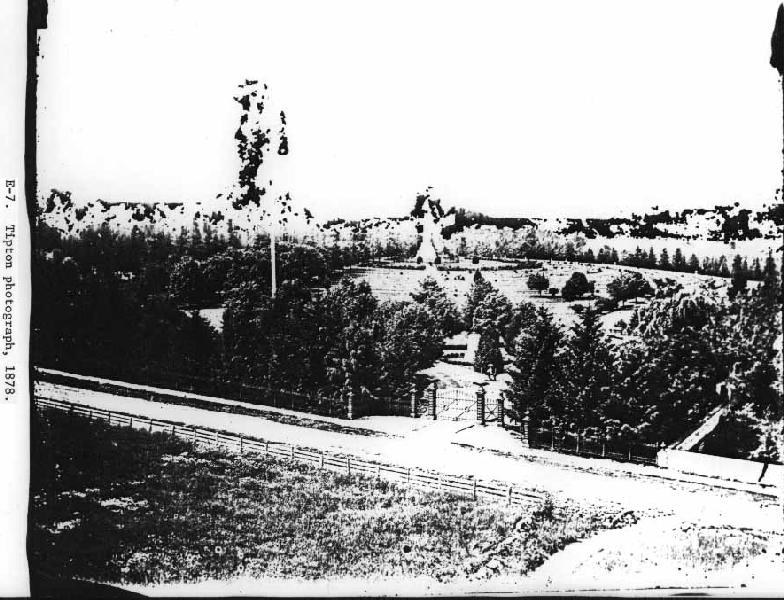
E-7. Tipton photograph, 1878.
It is uncertain from what vantage point this view was taken; it was photographed from the property of the Gettysburg Reservoir, and not from the East Cemetery Hill observatory.
This excellent view shows the entranceway to the National Cemetery from the Baltimore Pike in 1878 (thirteen years after the planting and construction in the National Cemetery). The wooden flagpole is visible toward the left-center of the photo, while the Soldiers' National Monument is in the center background. Except for the minimal planting in the grave section and the boxwood ring around the Reynolds statue, the Saunders planting plan was still quite evident and strictly adhered to.
The Baltimore Pike fencing is less sharply defined as in the 1865 views (A, C-3, C-4), since the evergreen plantings have grown and closed up the view into and out of the cemetery through the iron fence. The entranceway, however, has been improved by 1878 from its early condition (D) by laying brick sidewalk up to the pedestrian gates, and granite curbing along the entrance drive. The wall is all but obscured by the tree growth, except for the end of the wall at the pike, where the iron urn finial reflects the sun from its gilded surface.
(Tipton Collection, GNMP)
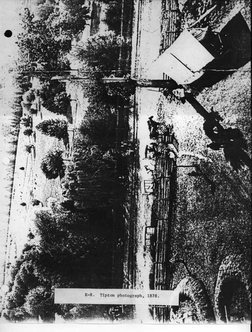
E-8. Tipton photograph, 1878.
This photograph from the East Cemetery Hill observatory is comparable to E-6, showing the facilities to accommodate parties for lectures, concerts, campfires, &c. which were frequently held at the site, as well as for visitors using the observatory. The only National Cemetery fencing visible in the photograph is the iron fence along the pike. National Cemetery boundary is at the weeping willow tree in the center of the photo.
(GNMP files)
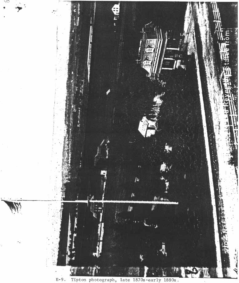
E-9. Tipton photograph, late 1870s-early 1880s.
This view from the East Cemetery Hill observatory tower shows the entranceway to the cemetery, with the mansard-roofed lodge, roof of the brick summer kitchen, frame storage house, and arbor lattice. The iron fencing parallels the brick sidewalk.
(GNMP files)
This is the best compositional photograph for the carriage and pedestrian gates, but it excludes the six posts and curving fencing of the entranceway. The most interesting feature of the photo are the half-globes on which the eagles are perched. Painted black like the posts, a five-pointed gold star was gilded onto the surface below and between the birds' talons (not visible in the photocopy).
(Tipton Collection, GNMP)
This view was taken from the roof of the lodge, and shows a view similar to E-7. The status of the vegetative growth is identical to E-7. and was also probably taken in 1878.
(GNMP files)
|
|
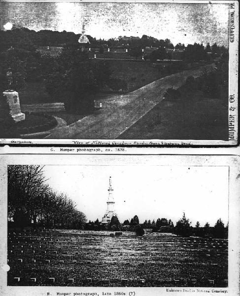
H. Mumper photograph, late 1880s (?).
This photograph from the unknown section shows the arbor vitae hedge beyond the Norway maples on the left. The hedge was Saunders' camouflage solution to the gas-pipe division fence. The arbor vitae shrubs encircling the Soldiers' National Monument have not been trimmed back and have overgrown their intended height limit.
(GNMP files)
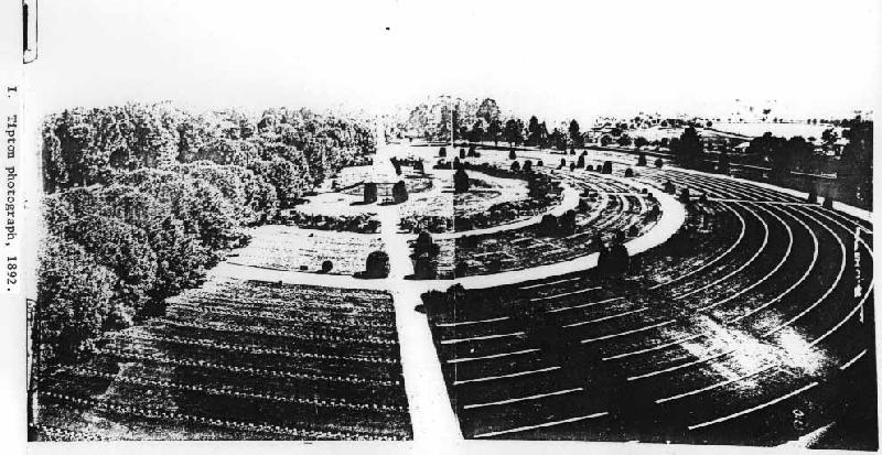
I. Tipton photograph, 1892.
This panoramic photograph was taken from the scaffolding used to erect the New York State Monument. The cemetery wall is now visible again because the War Department had just torn out most of the trees along the wall to provide a better view of the battlefield. The haphazard planting of trees and shrubs within the grave lots by the War Department is quite apparent here.
(Tipton Collection, GNMP)
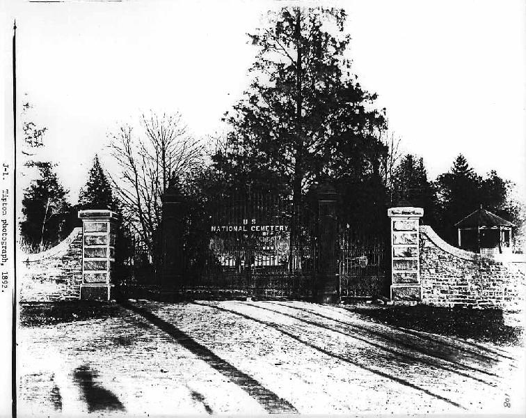
J-1. Tipton photograph, 1892.
This photograph was taken shortly after the new gateway was added to the Taneytown Road in 1892. The highly ornamental cast iron gateposts were not yet gilded at this time, and neither were the urn finials or U.S. insignia. The curved rising of the wall and coping was done especially for this project, as well as the rough-faced granite gateposts.
The structure in the cemetery at the right of the photograph is the summer house, removed by 1912 to make room for the Lincoln Speech Memorial.
(Tipton Collection, GNMP)
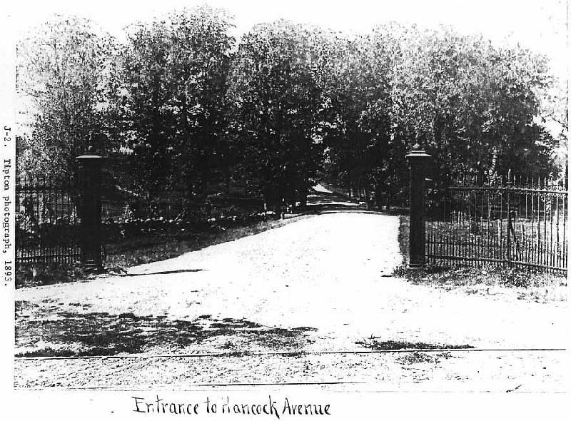
J-2. Tipton photograph, 1893.
This photograph was taken from the Taneytown Road at the old Hancock Avenue entrance at Ziegler's Grove. The gateposts and fence are part of the Lafayette Square fence and gateposts transferred to the Gettysburg Battlefield Memorial Association and erected in 1889. The Taneytown Road entrance/exit of the National Cemetery was put into the stone enclosing wall opposite this Hancock Avenue entrance to accommodate visitors and eliminate any inconvenience.
("Photographs illustrating the work of the Gettysburg National Park, GNMP library)
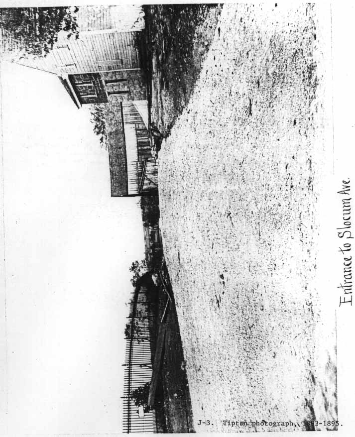
J-3. Tipton photograph, 1893-1895.
This view from the Baltimore Pike at the "Entrance to Slocum Avenue" shows the historic James McKnight farmhouse on the right and part of the Lafayette Square fence around East Cemetery Hill on the left. Notice the "G-clef" supports at the base of each post.
(Photographs illustrating the work of the Gettysburg National Park, GNMP library)
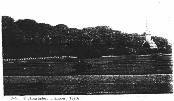
J-4. Photographer unknown, 1890s.
Showing the arbor vitae hedging along the gas-pipe fencing, beneath the Norway maples at the left of the photograph. The inner border around the Soldiers' National Monument shows an uncontrolled height similar to view H.
(GNMP files)
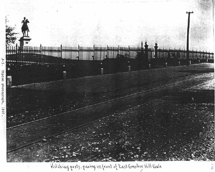
J-5. Tipton photograph, 1897.
This view shows the Lafayette Square fence as it stood fronting the Baltimore Pike at East Cemetery Hill. The "G-clef"-style supports are visible in this photo, bracing the rear of the posts and extending from the ground level to over one-half the height of the post.
(Photographs illustrating the work of the Gettysburg National Park, GNMP library)
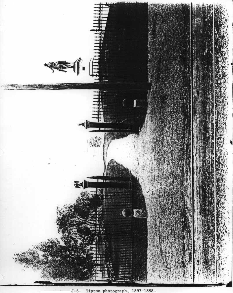
J-6. Tipton photograph, 1897-1898.
This photograph is also taken from the Baltimore Pike showing the Lafayette Square fencing at East Cemetery Hill. This detail shows one of the old gates and gateposts (like the first Hancock Avenue gateway, J-2) as well as the bracing for the posts.
(Tipton Collection, GNMP)
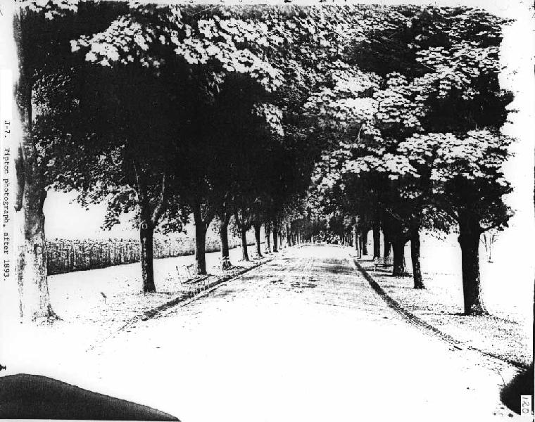
J-7. Tipton photograph, after 1893.
This photograph looks southward through the Norway maple avenue of the upper drive. The arbor vitae hedge along the gas-pipe fence appears at the extreme left.
(Tipton Collection, GNMP)
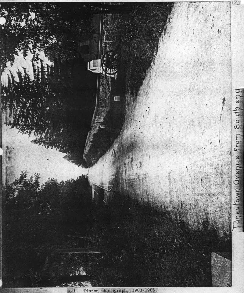
Taken from the Taneytown Road (at about the present entrance to the Cyclorama Center lot), this view looks northward, showing the cemetery wall on the right. The clean pointing stands out in contrast to the granite, and the pointing lines between the coping stones are also faintly visible.
(Photographs illustrating the work of the Gettysburg National Park, GNMP library)
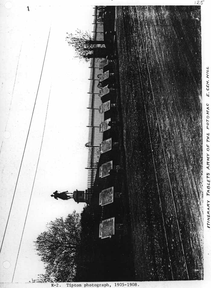
K-2. Tipton photograph, 1905-1908.
This photograph is comparable to J-5. showing the addition of the new itinerary tablets along the Baltimore Pike at East Cemetery Hill, and gives an indication of the condition of the Lafayette Square fencing after twenty years on the site.
(Photographs illustrating the work of Gettysburg National Park, GNMP library)
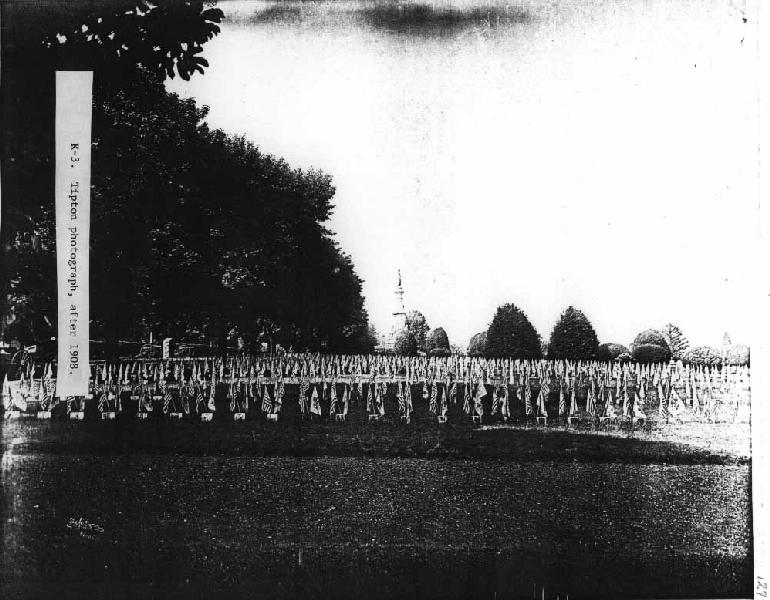
K-3. Tipton photograph, after 1908.
This Memorial Day photograph shows the unknown graves north of the Soldiers' National Monument, adorned with U.S. and Pennsylvania state flags. The arbor vitae hedge has grown to a trimmed height higher than the custom of the 1880s (when it just reached the height of the back of the benches). It now rises above the wheels of the artillery carriages. The interior plantings of the War Department, and the uncontrolled growth of the beltway around the Soldiers' National Monument, has closed up the open expanse of the soldiers' grave section.
The Norway maples have been thinned out since the view J-7.
(GNMP files)
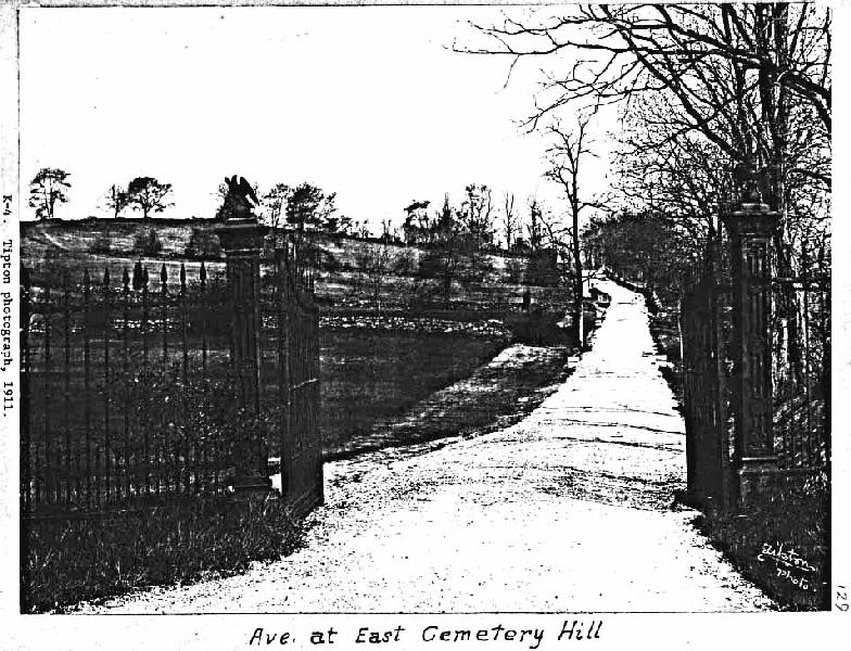
K-4. Tipton photograph, 1911.
This view looks down Wainwright Avenue from the Lafayette Square gateway at Slocum Avenue, at the base of East Cemetery Hill.
(Photographs illustrating the work of Gettysburg National Park, GNMP
library).
This view shows the condition of the gas-pipe division fence before it was removed during the winter of 1933-1934. Because successive severe winters had killed off portions of the arbor vitae, the hedge along the fence had been removed previously, revealing the dilapidated fence (virtually uncared for for three decades).
(GNMP files)
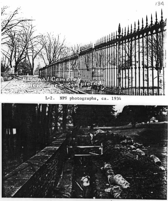
L-2. NPS photographs, ca. 1934.
These photographs illustrate the work done by the C.C.C. in the cemetery in 1934, including the erection of the Lafayette Square fence along the Evergreen Cemetery and Soldiers' National Cemetery boundary and putting drainage along the inside of the northwest wall in an attempt to alleviate the water build-up there. The lower photograph shows the wall bulging in this area as early as 1934, but also shows adequate pointing between the coping stones, and some patchwork pointing along the wall's inner face.
(GNMP files)
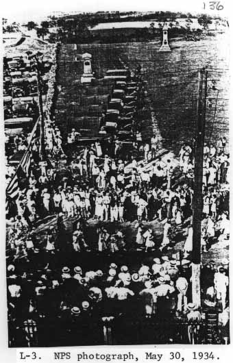
L-3. NPS photograph, May 30, 1934.
This photograph, taken one month after the National Park Service took over active administration of the National Cemetery, shows a highly reflective surface on the gilded urn at the lower right hand corner.
(Superintendent's Reports, May 1934, GNMP files)
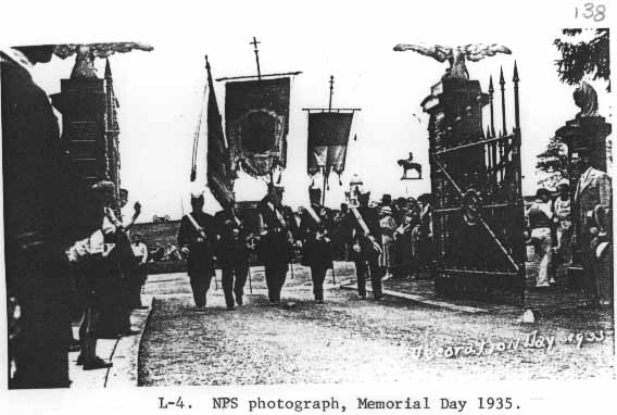
L-4. NPS photograph, Memorial Day 1935.
Shows the Baltimore Pike gates and gateposts, in a painted and gilded condition, prior to the widening of the entranceway in 1939.
(Superintendent's Reports, May 1935, GNMP files)
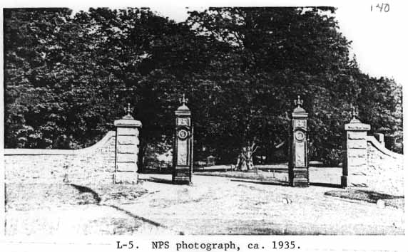
L-5. NPS photograph, ca. 1935.
This photograph shows the Taneytown Road entranceway to the National Cemetery, with all gates open. The ornamental features of the posts have been gilded since their erection in 1892
(view J-1).
(GNMP files)
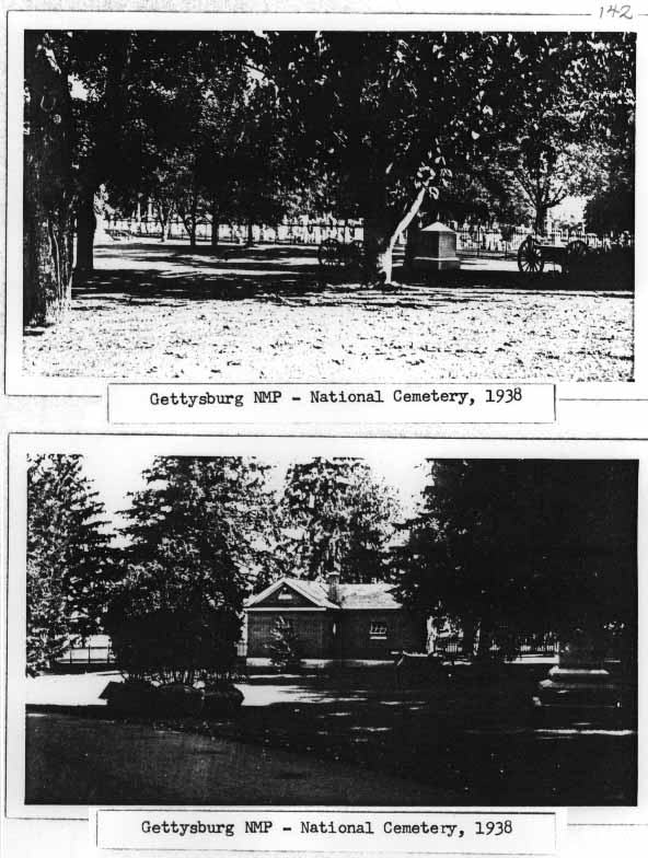
L-6. NPS photographs, 1938.
These views show the re-erected Lafayette Square fence along the upper drive before the rhododendron was planted along the line of the fence in 1938.
(GNMP files )
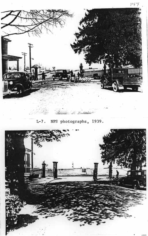
L-7. NPS photographs, 1939.
These photographs were taken at the time the W.P.A. widened the Baltimore Pike gateways in the spring of 1939.
(Superintendent's Reports, Spring 1939, GNMP library)
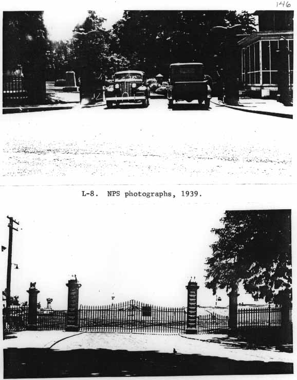
L-8. NPS photographs, 1939.
These photographs were taken to show the changes made by widening the Baltimore Pike gates. The ornamentation was newly gilded, and new, wider gates were hung.
(Superintendent's Reports, spring 1939, GNMP library)